
Stretching from Wangaratta through to Bairnsdale is the Great Alpine Road, a 300 km driving and touring experience of valleys, mountains, forests, rivers and ocean. This drive takes you through Victoria’s largest national park, the Alpine National Park, which contains 10 of the 11 highest mountains in the state. It’s highest point, 1,750 metres, is at Mount Hotham.
This great touring experience will take you through a journey of time, where you can come face-to-face with a heritage encompassing the Aboriginal culture, European settlement, gold fever, winter wonderlands and the legends of the mountain cattlemen.
Great Alpine Road Attractions
An Alpine Cathedral Picnic Area
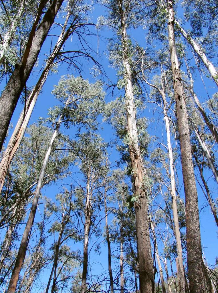
Located on the Great Alpine Road, just over the midway point from Bright to Mount Hotham is this delightful picnic area, surrounded by Alpine Ash (Eucalyptus delegatensis) or ‘Woollybutt’ that grows only between between heights of 900 and 1,450 metres, where the ground is cold enough from weeks of snow to allow its seeds to germinate.
The Alpine Ash is one of the tallest flowering plants in Australia and one of Victoria’s high quality timber species. The vast Alpine Ash forest of the alps came under intense pressure during the 1950’s and 1960’s, when demand for home building materials rose dramatically.
Carefully managed, sustainable harvesting continues in areas of State Forest to provide timber products which are not available from other sources. Much of the demand for home building materials is met by quickly maturing plantation pine, which can be seen in the valleys surrounding the alps.
Fire
Fire plays a natural role in the Australian forest. A high intensity fire (usually between mid summer and autumn), although destructive, also heats the soil and canopy, encouraging seed drop, germination and subsequent dense seedling regrowth.
Each plant species has it s own survival features, which assist in recovery after fire. The Alpine Ash, for example, is destroyed by severe fire and regenerates only from seed.
Wildfires caused by lightning strikes cause about a quarter of the 600 fires that occur on average in Victoria each year, but they account for about half of the area burnt.
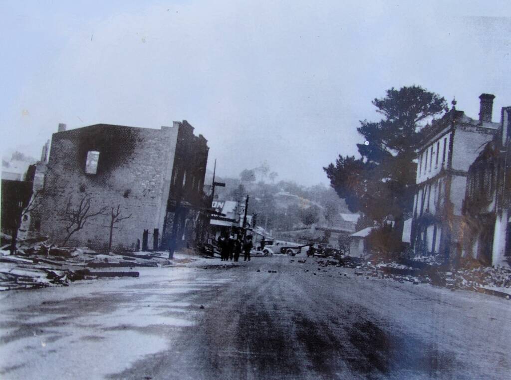
Fires such as those of Black Friday, January 13, 1939 and the more recent 2003 fires are well remembered in the high country. In 1939, throughout Victoria, the fires destroyed 1.6 million hectares of forest and grazing country and claimed 71 lives. The alps were ablaze and many of Omeo’s grand gold era buildings were lost. In 2003 vast tracts of the Alpine National Park were burned as well as extensive grazing land, fences and some buildings.
Source: Information and image from park signage.
Image Latrobe Picture Collection, State Library of Victoria
Victorian Alpine Region > Beechworth | Benalla | Chiltern | Corryong | Eildon | Falls Creek | Glenrowan | Harrietville | King Valley & Milawa | Kinglake | Lake Mountain | Mansfield | Mount Beauty | Mount Buffalo | Mount Buller | Mount Stirling | Mountain Creek | Rutherglen | Tallangatta | Yackandandah | Yea
Great Alpine Road > Alpine National Park | Bairnsdale | Bright | Dinner Plain | Harrietville | Lakes Entrance | Mount Hotham | Myrtleford | Omeo | Oxley | Porepunkah | Wangaratta ◦ Other regions: Victoria’s High Country | NSW Snowy Mountain Region
Other towns, villages and localities in the Great Alpine Road include: Bruthen • Ensay • Eurobin Falls • Everton • Ovens • Swifts Creek • Tarrawingee
Footnote & References
- Alpine Shire – the shire site has plenty of information for visitors including attractions, maps, festivals and events, https://www.alpineshire.vic.gov.au/
- Tourism and Events, Alpine Shire Council, https://www.alpineshire.vic.gov.au/community/tourism-and-events
- Mt Hotham Track Notes, Self Guided Eco Walk, Mt Hotham Track Notes – Bushwalking Victoria, https://bushwalkingvictoria.org.au/
VictoriaAlpine National Park Bright Dinner Plain Falls Creek Glenrowan Great Alpine Road Great Ocean Road Kyabram Mount Beauty Mount Buffalo Mount Hotham Mountain Creek Phillip Island Sullivans Lookout Victorian Alpine Region Victoria’s High Country Wilsons Promontory National Park