
— see Barunguba Montague Island | South Coast
Wallaga Lake is the largest lake in southern New South Wales, located between Bermgaui (in the south) and Tilba Tilba (to the north). It is situated beneath the breathtaking Gulaga Mountain (Mount Gulaga, formerly known as Mount Dromedary), in the traditional lands of the Yuin People. A large part of the Wallaga Lake foreshore and catchment are within the Gulaga National Park, a park that (in 2001) encompassed the former Wallaga Lake National Park, Goura Nature Reserve and Mount Dromedary Flora Reserve. The remainder of the catchment is mostly comprised of by Bermagui State Forest and private properties.1
Wallaga Lake and the majority of its catchment falls within the Bega Valley Shire Council Local Government Area (LGA), with the northern section of the catchment falling within the Eurobodalla Shire Council LGA. The LGA boundary is along the northern shore of Wallaga Lake and Dignams Creek.
Wallaga Lake’s surface area is 7.8 km2, with a catchment area that spans 280 km2. It is an estuarine lake, and is fed by two major tributaries, Dignams Creek and Narira Creek.
An estuary is a coastal body of water that is partially enclosed, with one or more rivers, creeks, streams flowing into it and connected to the ocean. Estuaries form a transition zone between river and maritime environments.
The lake biodiversity include seagrass beds, swamps, saltmarsh and wetlands. It is also commercially harvested for finfish, prawns and oysters, with Meads Bay (an area withing the estuary) a fish nursery. Wallaga Lake is also a popular tourist destination, that offers a host of recreational activities.

This small knob of land just over Wallaga Lake Bridge was once known as Payne’s Island.
“Allawah” House, operated as a guesthouse, once stood on the island advertised “Situated on the Wallaga Lake, near the Bridge, on the main road between Bermagui and Tilba Tilba, right in the midst of best fishing spots.”
The property was run by fisherman Jack Payne’s parents and provided meals and accommodation, a camping ground, a store for supplies and fresh water.
When the lease expired in the 1930s the building was relocated near the caravan park next to the Montreal Goldfield.

Within Wallaga Lake is the Merriman’s Island (also known as Merriman Island or Umbarra). The lake is also home to the black duck, the totem that is connected with the elder Umbarra (aka “King Merriman”, who died in 1904).
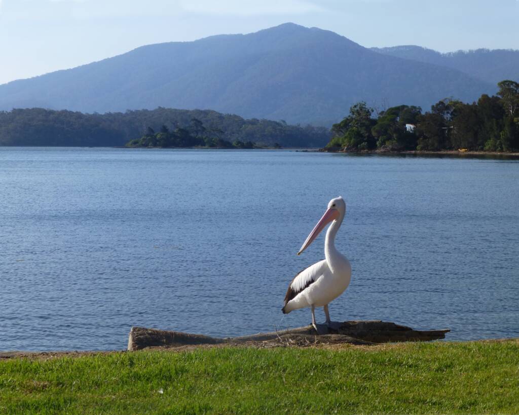
Following photograph of Merriman Island in Wallaga Lake with Gulaga in the background. There are extensive middens in the area around the lake2.
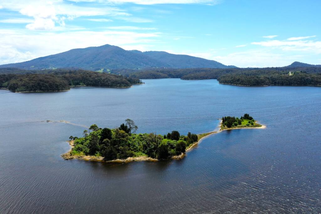
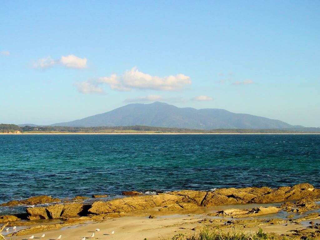
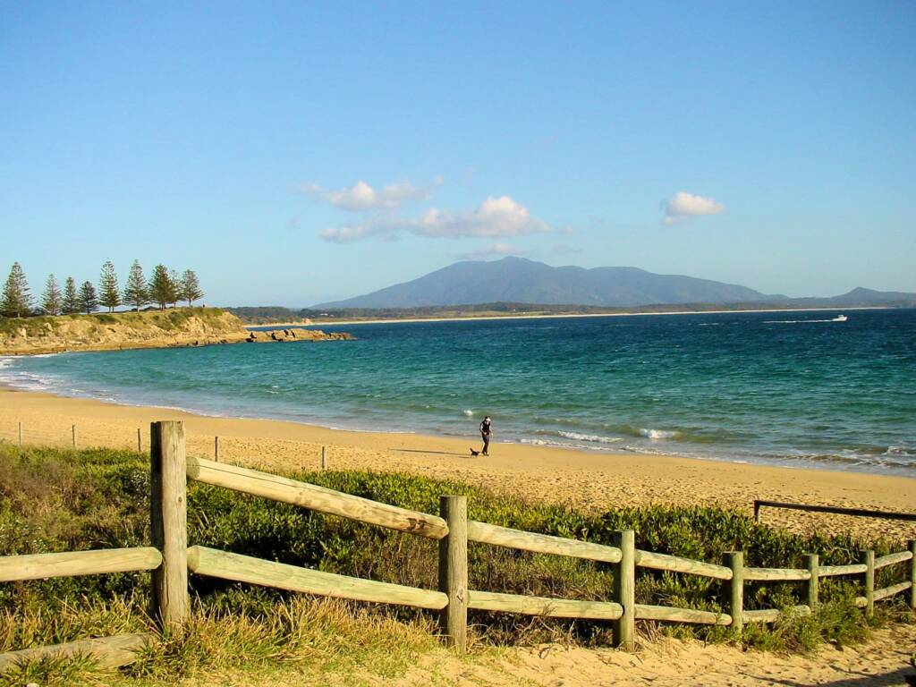
Gulaga (Mount Gulaga, formerly known as Mount Dromedary), is a striking landmark that can be seen from many different locations in the area.
Footnote & References
- Honeysuckle Island and Paynes Island (Wallaga Lake), Author / Photographs © Phil Warburton
- SOUTH COAST Coast ISLANDS New South WAles, A Guide to the 61 Islands of the South Coast of NSW, Authors Helen Moody with Mike Jefferis, ISBN 9780858810037, https://envirobook.com.au/product/south-coast-islands-new-south-wales/
- Wallaga Lake – Background information, Bega Valley Shire Council Coastal Management Programs, Bega Valley Shire Council, http://begavalley.wrl.unsw.edu.au/index.php/coastal-management-programs/estuaries/wallaga-lake/background-information/
- Wallaga Lake, Wikipedia, https://en.wikipedia.org/wiki/Wallaga_Lake
- Djiringanj – Yuin Nation, Bermagui Historical Society, https://www.bermaguihistoricalsociety.org.au/djiringanj-yuin-nation/
- Yuin Moruya Community, Storylines, https://moruya.storylines.com.au/2016/08/29/wallaga-lake/
South CoastBioblitz! The Eurobodalla Regional Botanic Garden Eurobodalla National Park Gulaga / Mt Dromedary Fauna Flora Islands National Parks and Reserves Wallaga Lake
New South WalesNew South Wales Fauna New South Wales Flora Barunguba Montague Island Blue Mountains Bourke Bundeena Central Coast Kosciuszko National Park Lower North Shore Lightning Ridge Mount Kaputar National Park Northern Beaches Sapphire Coast Snowy Mountains Region South Coast Stony Range Regional Botanic Garden Sydney