

River, Lakes, Waterholes in Central Australia
Amadeus Basin | Finke River System | Hugh River | Ilparpa Claypans | Palm Valley | Roe Creek | Todd River | Waterways in Alice | West MacDonnell Ranges ◦
Finding water in Central Australia is easy if you were one of the original inhabitants, who knew the signs and where to look, but for the first European explorers it was a very different story. Central Australia is a vast arid region that stretches from Western Australia, through southern part of the Northern Territory, northern part of South Australia and the south west corner of Queensland.
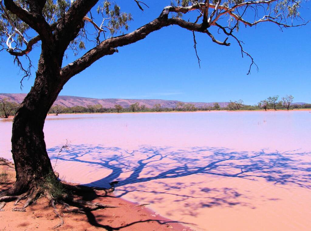
It is a region spanning endless flat landscapes, huge sand dunes, salt encrusted claypans and lakes, gorges and mountain ranges. Etched in this desert landscape are the tracks of dry river beds cutting across the land, many seeming to just disappear into the sand, whilst others converge from tributaries into the major arterial riverways, that flow in to dry basins and lakes, that may be salt encrusted, such as can be seen at Australia’s largest salt lake, Lake Eyre.


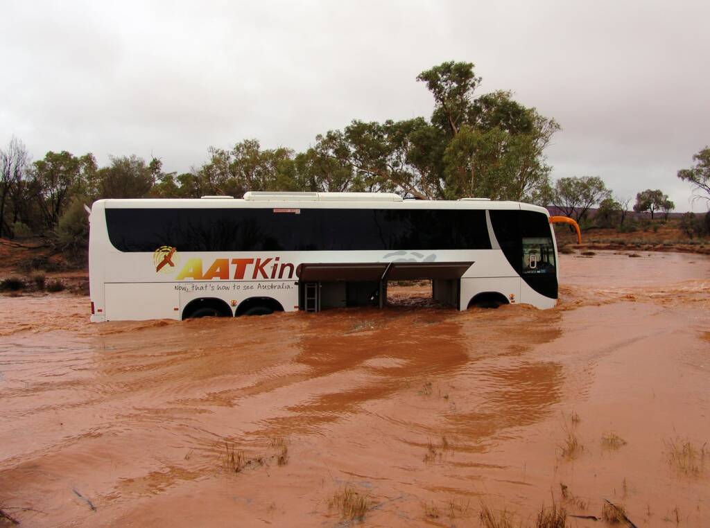

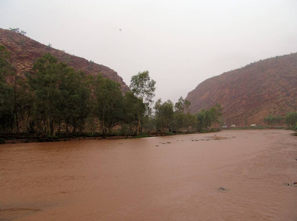
Rainfall is a rare occurrence in Central Australia compared to other parts of the continent. Yet when it does rain and depending on where the rain falls, the storm severity and the amount of rainfall, the rain can bring flash floods and torrents, with the deluge sweeping through formerly dry channels and dry riverbeds. These swollen rivers carry such force that whole trees, boulders, pebbles, sand and other debris can be swept along the rivers.
Many roads get cut off, and unwary or foolhardy driver have had their vehicles swept along the river whilst attempting to transverse roads that are in the path of the swollen rivers.

Many of the better known transient river that flow include the Finke River and the Todd River, often attracting locals and tourists to the river edges to witness these rare occurrences.
After such torrents, the river seem to simply disappear, as the water passes, leaving dry river beds, with the most obvious evidence being trees and debris left caught wrapped around trees that grow along the tracks of the rivers.
Such rain often fill dried rock holes, replenish the permanent waterholes, claypans and lakes, and depending on the amount of water that has fallen, can be the trigger for the appearance of an amazing array of life. Desert and burrowing frogs appear, mate and lay their eggs, spawning the cycle of tadpoles and frogs. Desert fishes seem to appear out of nowhere, with the water providing habitats for a variety of amazing tiny crustaceans such as fairy shrimp, clam shrimp and shield shrimp.
These small crustaceans lie dormant in the clay and sand, awaiting the arrival of rain. Once enough water has fallen, it is the trigger for the eggs to hatch. Like a number of other creatures in this arid landscape, they live an accelerated life cycle, laying more eggs before they die.
Just as suddenly as they appear, rivers can dry up within days or hours, often leaving debris deposited across the roads. Some rivers can last longer, depending on the amount of rain that has fallen in the region, especially if the rivers are fed by a number of effected tributaries. Such rain fall patterns are often the result of weather conditions during the big wet up the far north, or rain clouds blown across from Western Australia and Queensland.
Many of these wet weather conditions are a welcomed change in a region where rain is infrequent.
- Finke River System
One of the largest river systems in Central Australia is the Finke River, also cited as being ‘the oldest river in the world’. It begins in the MacDonnell Ranges in the Northern Territory.
‘The Finke’ starts at the confluence of the Davenport and Ormiston Creeks, just north of popular Glen Helen. It then meanders for some 600 plus kilometres passing through the Finke Gorge National Park and like the Hugh, Palmer and Diamantina rivers all flowing inland, to the western edge of the Simpson Desert in northern part of South Australia and eventually ending up in Lake Eyre.
The Finke River winds pass Palm Valley, in fact, those visiting Palm Valley will find that part of the route is along the dry river bed of the Finke River. During times of heavy rain in the region, water also flows through Palm Valley to feed into the Finke River.
- Ilparpa Valley / Ilparpa Claypans
Just south of the West MacDonnell Ranges, approximately 15 km south east of town is one of the lesser known Alice Springs attractions, the Ilparpa Claypans. A very scenic locale and home to a fragile ecosystem and local wildlife sanctuary.
The claypans are listed as a ‘Site of National Botanical Significance’ due to the presence of significant ephemeral plants and a wide diversity of plant species and communities. It is also registered as an Aboriginal Sacred Site, that is an important cultural place, especially for Arrernte Custodians.
The claypans are located at the western end of the Ilparpa Valley, the twelve interconnected ephemeral claypans form part of the Roe Creek catchment.
Check out our Ilparpa Claypans and Snapshots from the Ilparpa Claypans.
- Palm Valley
Located within the Finke Gorge National Park is the internationally renowned Palm Valley, a narrow gorge that is home to the Red Cabbage Palm (Livistona mariae), remnants of a tropical rainforest that covered this area 60 million years ago.
Much of the lush vegetation in the area is fed by groundwater discharging from the deep sandstone aquifer. The spring water can be seen seeping from small fractures and bedding planes at a number of places along the valley floor.
- Todd River
Anyone who has visited Alice Springs, will be aware that the town sits on the Todd River. Like most rivers in Central Australia, the Todd River is a dry sandy river bed whose origins begin in the MacDonnell Ranges region. From there it winds its way pass the Telegraph Station, almost through the centre of Alice Springs, out through Heavitree Gap and continuing on for some distance before it becomes a tributary of the Hale River, that eventually flows into Lake Eyre in South Australia.
The indigenous Arrernte people of this area of Mparntwe, know this river as Lhere Mparntwe (pronounced ler-ra m-barn-twa) where it runs through Alice Springs (Mparntwe) and Lhere Imatukua (pronounced ler-ra imma-tooka) as a whole.1 These names where recorded by TGH Strehlow in “Songs of Central Australia”.2
The Todd River has a catchment area located mainly to the North of Alice Springs and when heavy rainfall occurs in and around this catchment area, the Todd River will usually flow. If heavy rainfall doe not in this Alice Springs catchment area, the Todd River will usually only reach a trickle flow.
Alice Springs usually experiences its heaviest rainfall during the summer months between November through to March, and generally as a result of equatorial troughs moving inland across Central Australia. Any heavy rainfall, together with the rocky terrain and steep river slope of the catchment area, is conducive to flash flooding in the Todd River.
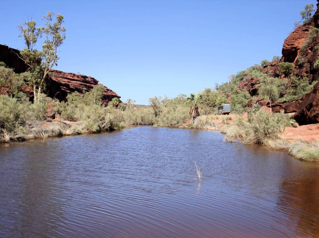
The Todd and the Finke, are typical examples of rivers throughout Central Australia. On the surface they appear to be dry, although at certain points along the length of the river you may find the occasional water hole. Places like Ellery Creek Big Hole and the Boggy Hole are examples of waterholes that rarely run dry.
Check out Todd River – A Rare Occurrence
Central Australia Attractions | Water in Central Australia | Waterways in Alice | Weather | Wildflowers of Central Australia
Footnote & References
- Alice Springs, Wikipedia, https://en.wikipedia.org/wiki/Alice_Springs
- Strehlow, Theodor G. (1971). Songs of Central Australia. Sydney: Angus & Robertson. ISBN 978-0-207-94657-8.