
The Oodnadatta Track, also known as the ‘Oodna’ Track’, is a well known outback route that follows the Old Ghan railway line towards Alice Springs. This was the route for 19th century explorers such as John McDouall Stuart. The track follows an old Aboriginal trading route, that passes through semi arid desert country, disused railway sidings and other ruins, and passing artesian springs and waterholes along the way.
Today, it provides a holiday route for many tourists, eager for some history, adventure and a taste of the outback.
The Oodnadatta Track officially starts from Marree in the south or Marla in the north. Some maps show it starting from Lyndhurst, south of Marree, whilst many travellers have made Leigh Creek and Copley as their starting point.
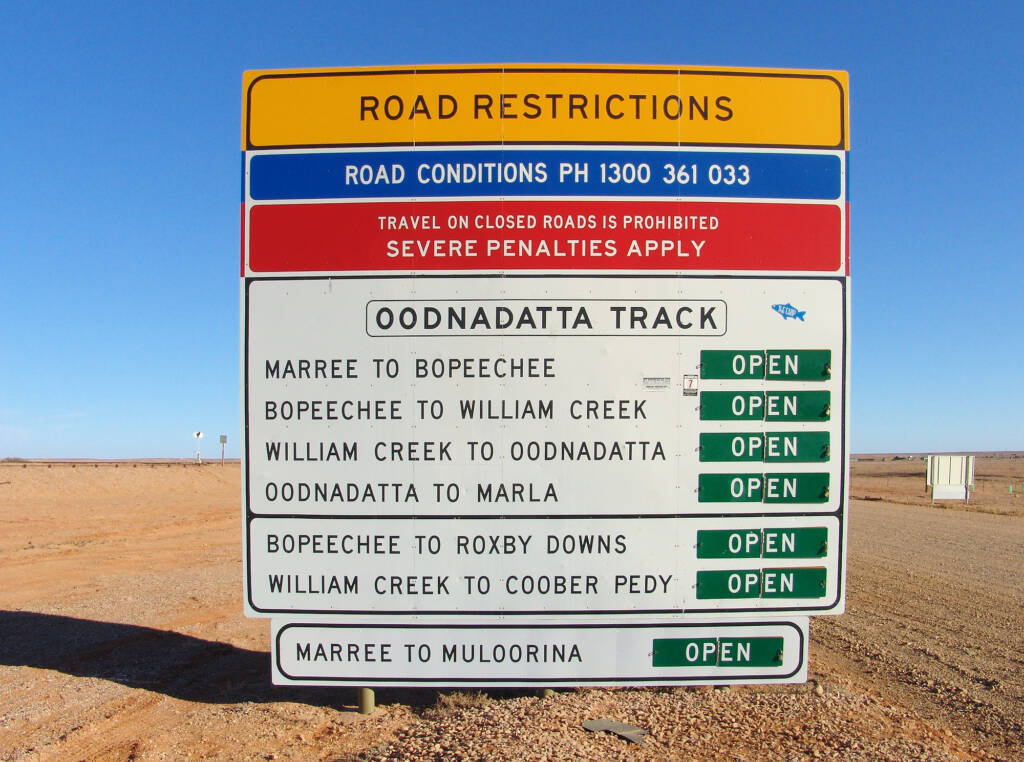
Travellers departing from Marree will see the familiar signs (road restrictions and warning) as they begin their adventure along the Oodnadatta Track.

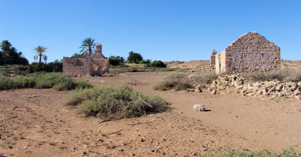
The township of Oodnadatta is the historic centre that was once a crossroad thronged with drovers, cameleers, goldminers and Aboriginal people, that became even more of a hub when the transcontinental railway started its construction in 1891. Before it was completed in 1929, all the mail, freight and travellers were transhipped, taking six days on camelback, to Alice Springs.
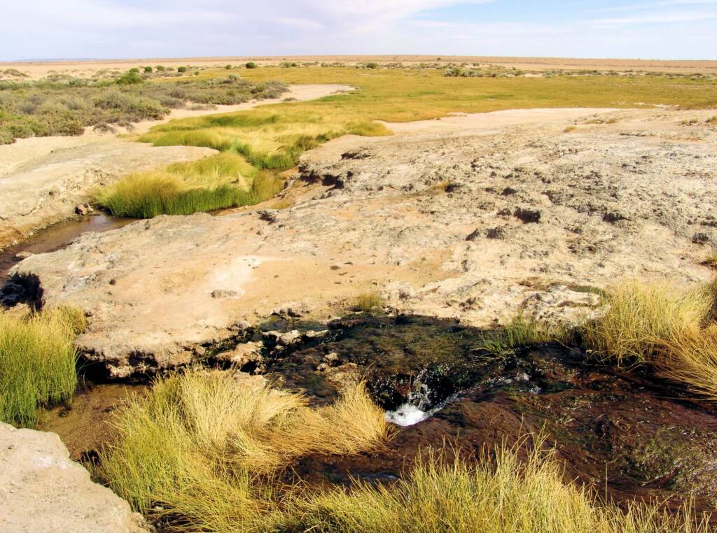
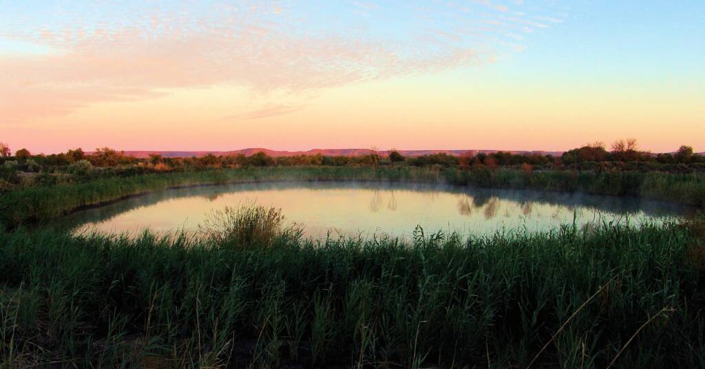
Visitors to the Oodnadatta Track might think that they are journeying over waterless plains. But beneath them lies one of the world’s largest aquifers, the Great Artesian Basin.
How long does it take to do the Oodnadatta Track
For those planning the trek, it is usually an easy drive along unsealed road, with camping facilities and opportunities at a number of locations along the route, including Coward Springs and the pub at William Creek. Stretching 620 km from Marree in the south, to Marla in the north, you can take the Stuart Highway down to Cooper Pedy and either follow the route back up to Oodnadatta or pass Anna Creek to William Creek. The road is unsealed with sandy patches that can become impassable after rain and you should ensure you are fully equipped with supplies and spare tires and means of communication. Depending how long you spend at each location and how many stop-offs (great photographic opportunities), the journey can take a couple of days to a couple of weeks.
You can also make Marree/Oodnadatta the departure point for crossing the Simpson Desert and visiting the Witjira National Park, the road closely follows the route of Charles Todd’s Overland Telegraph Line which ran from Port Augusta to Darwin.
Near William Creek, there’s a detour to Lake Eyre North, a massive salt lake that fills up about every 100 years. Travellers should sought advice and the condition of the track before tackling it.
The Oodnadatta Track is also home to Anna Creek Station, the worlds largest cattle station covering some 34,000 sq km (6 million acres) and belonging to the Kidman group of properties. The next largest cattle station is in the Northern Territory Alexandria Station at 8,000 sq km. The largest cattle property in the USA is small in comparison at only 3,000 sq km.


Oodnadatta is an aboriginal word meaning ‘blossom of the mulga’. The Oodnadatta Track crosses the traditional lands of three Aboriginal groups. In the south, between Lake Torrens and Lake Eyre are the Kuyani people; most of the west of Lake Eyre has been traditionally occupied by the Arabana people; and to the north is the land of Arrernte people. Now may people from further west, Antikirinya people, live here too.1
Check out the following for further information and contacts:
- Department for Environment and Water, South Australia – Contact Us
- National Parks and Wildlife Service, South Australia – www.parks.sa.gov.au
Some of the attractions and destinations that you can include as part of your Oodnadatta Track experience (alphabetically listed), include:
Alberrie Creek | Algebuckina Bridge | Coward Springs | Lake Eyre | Marla | Marree | Oodnadatta | Strangways Springs | Wabma Kadarbu Conservation Park | William Creek | Witjira National Park – includes Dalhousie Springs
Footnote & References
- Australian Government: Australia’s National Heritage – Witjira-Dalhousie Springs, South Australia. Retrieved July 28, 2012
South AustraliaSouth Australia Fauna South Australia Flora Adelaide Hills Alberrie Creek Algebuckina Bridge Belair National Park Flinders Ranges & Outback Kangaroo Island Kanku–Breakaways Conservation Park Mount Gambier Oodnadatta Oodnadatta Track Orroroo Port Augusta Port Germein Wabma Kadarbu Conservation Park William Creek Wilpena Pound Witjira National Park Woomera